


Key events
Bom forecaster Jonathan Howe has told the ABC that the impact from wind and rain will still be significant.
Regardless of whether it does cross as a category one, two, or three, we are still expecting that very heavy rainfall and life-threatening flash flooding well before the crossing and well after the crossing as well and that very dangerous storm surge.
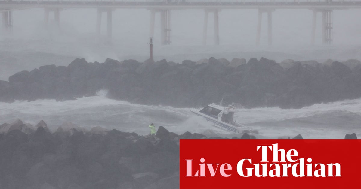
The outer part of the storm is lashing the coast on an enormous sweep from the Sunshine Coast to Grafton in northern NSW, with wind speeds touching 111kmh at Byron Bay.
Evacuation order in northern NSW
The NSW SES has issued 21 emergency warnings, 36 watch & act warnings and 36 advice warnings.
They include prepare to evacuate advice for several areas in northern NSW including Murwillumbah, South Murwillumbah and Settlement Point due to flooding risk.
The SES advised people in parts of Mullumbimby to the east of the railway line to monitor the situation and prepare to evacuate. An evacuation centre has been set up at the Ocean Shores Country Club.
More on Alfred’s movement through the night
As we’re all now beginning to realise, Alfred is slow moving and not entirely predictable in its movements. The past few hours underline this.
At one point in the night – according to the update at 11pm AEST – it appeared to do another turn away from the coast and was 240km off the coast. At 7pm it had been 225km east of Brisbane.
By the time BoM issued its next advice at 1.34am, it appeared to have righted itself again and was heading back towards land.
“After being slow moving for several hours, Tropical #CycloneAlfred is moving to the west once again, towards Qld coast,” the BoM said.
The current tracking map shows that it will be about 25km off the coast by 1am on Saturday morning, by which time it will have weakened to a category 1 storm.
Good morning
Welcome to our live coverage of Tropical Cyclone Alfred.
The latest advice from the Bureau of Meteorology at 4.52am AEST places Alfred 195km east of Brisbane. It has travelled 30km since the forecast issued by the BoM at 7pm, when it was 225km east of the city. It continues to be slow moving.
The latest advice says the eye of the storm is still tracking to cross the coast on Friday night or early on Saturday morning, “most likely close to Moreton Bay between Noosa and Coolangatta”, and will have weakened to a category 1 storm.
But the effects of the storm are already being felt over a large area – and the next 24 hours are likely to be tough for the millions in or near the storm’s path.
The BoM said there was “a very high risk of significant impacts due to widespread heavy rainfall over the coming days”.
Communities from Double Island Point in Queensland to Grafton in New South Wales, including Brisbane, Gold Coast, Sunshine Coast, Byron Bay and Ballina but not including Grafton, are all in the warning zone.
The storm will be packing heavy rainfall which could bring life-threatening flash flooding, the BoM said, along with very strong winds, storm surges and high tides.
We will be bringing you updates throughout the day.
