Winds that have fanned wildfires in the US city of Los Angeles are again expected to kick up in the early hours of Wednesday – after a 25th death from the huge, week-long outbreak was confirmed.
Forecasters have again identified an area of “extreme fire danger”, emphasising the risk level in a region to the north-west of the city centre.
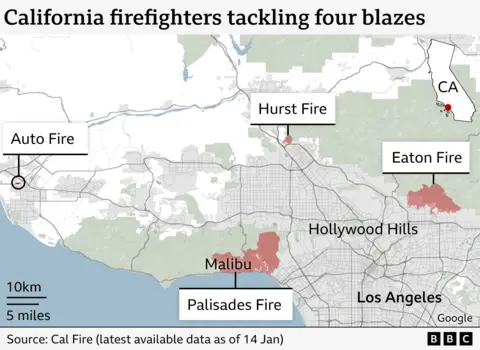
The anticipated increase in wind speeds threatens to further fan the remaining four blazes, which firefighters have made further progress in tackling during a few days of calmer conditions.
There are hopes of another drop in wind speeds after Wednesday – but officials have highlighted the need for rain that would help fire crews in their battle.
The 25th death was confirmed by the LA County Medical Examiner’s Office. Thirteen other people remain missing.
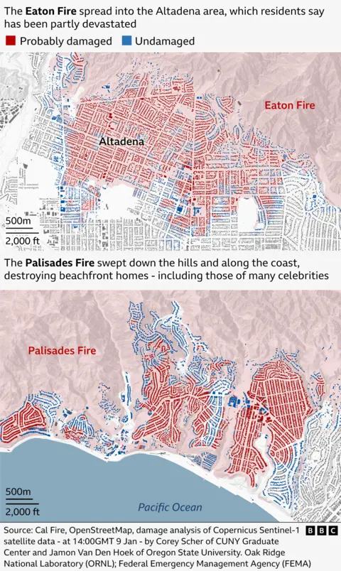
Most of the victims have died in the Eaton Fire, which has burned more than 14,000 acres to the city’s north, but has now been 35% contained by firefighters.
Further west, the larger Palisades Fire has torched more than 23,000 acres, and is now at 18% containment. Two smaller fires also continue to burn.
Some of the victims of the Eaton Fire have now been allowed to return to their homes, although officials say they have no firm date for repopulation of the Palisades area, an upmarket area ravaged by the fire to which it lent its name.
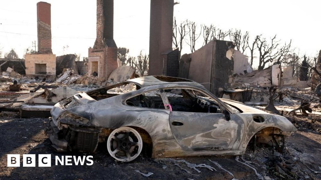
Tens of thousands of people are therefore still under evacuation orders – where night-time curfews also apply – and thousands of homes have been destroyed in one of the costliest natural disasters in American history.
On Tuesday, Los Angeles Mayor Karen Bass described the scenes as “unimaginable”, vowing to exercise her executive powers to trigger rapid rebuilding efforts.
Setting out other measures to help locals, another official, the LA County supervisor, said an emergency proclamation would be issued to prevent alleged price-gouging by LA landlords amid the crisis.

Wednesday’s critical conditions are due to the effects of moderate to locally strong Santa Ana winds coupled with very low humidity, said BBC Weather forecaster Sarah Keith-Lucas.
The winds are expected to peak again at 03:00 local time (11:00 GMT) for a period of twelve hours, according to the local office of the National Weather Service (NWS). Gusts could reach 50mph (80km/h).
Compared with last week’s conditions, winds are “weaker but still strong”, the NWS cautions.
For that reason, areas to the north-west of Los Angeles – including Simi Valley and Thousand Oaks – have been deemed to be particularly dangerous.
But an improvement in conditions is forecast later on Thursday and into Friday. Despite a change in winds, no rainfall is forecast for at least the next week, BBC forecaster Sarah Keith-Lucas added. And the Santa Ana winds that have been blamed for stoking the blazes could again develop from Sunday.
The fire chief for the city of Pasadena echoed the need for precipitation.
There had been no “real rain in southern California” for more than 250 days, Chad Augustin told BBC Radio 4’s Today programme.
On Wednesday, his firefighters would be on “standing guard ready to ensure that we hold our containment lines and we don’t burn up any more structures”, Mr Augustin added.


